Explore
Featured
Recent
Articles
Topics
Login
Upload
Featured
Recent
Articles
Topics
Login
Upload
Search Results for 'map lake'
map lake published presentations and documents on DocSlides.
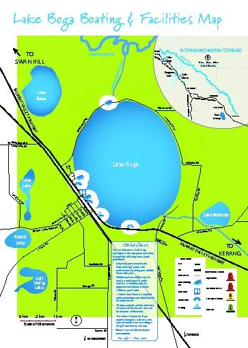
Lake Boga Outfall ChannelLittle Murray River
by anderson
Lake Boga 0 km.5 kmScale of Kilometres1 km Lake Bo...
Lake Boga Outfall ChannelLittle Murray River
by desha
Lake Boga 0 km.5 kmScale of Kilometres1 km Lake Bo...
Source Wisconsin Department of Natural Resources 6082662621
by davies
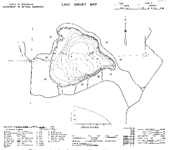
Paya Lake 150 Oconto County Wisconsin DNR Lake Map...
Source Wisconsin Department of Natural Resources 6082662621
by della
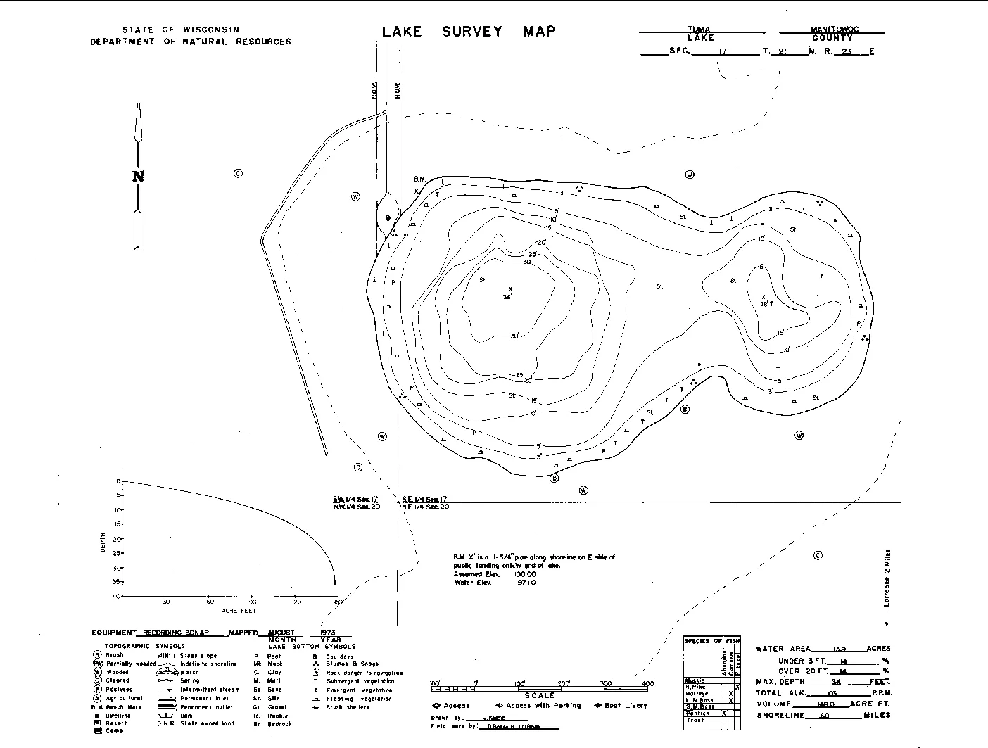
Tuma Lake 150 Manitowoc County Wisconsin DNR Lake ...
Source Wisconsin Department of Natural Resources 6082662621
by callie
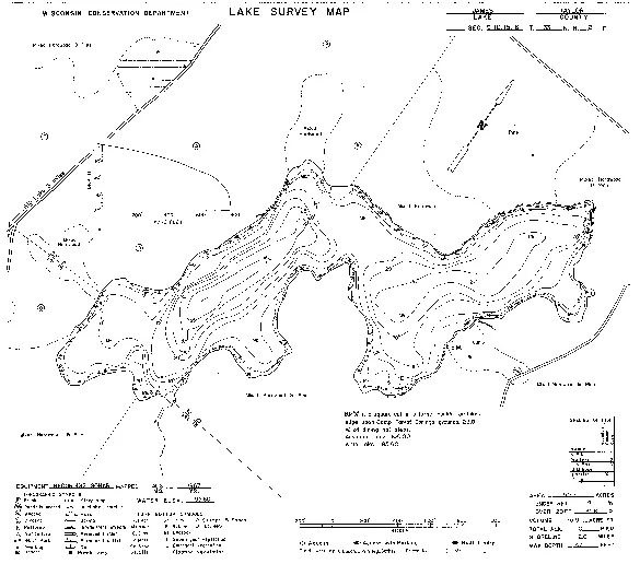
Van Zile Lake 150 Florence County and Forest Count...
Source Wisconsin Department of Natural Resources 6082662621
by gabriella
James Lake 150 Taylor County Wisconsin DNR Lake Ma...
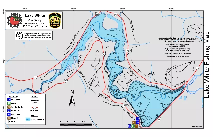
333 Acres of Water
by bella
323000324000325000326000433000143310014332001100 M...
Manual of Fisheries Survey Methods IIJanuary 2000Chapter 12Manual of F
by hanah
Clarence M TaubeSuggested citationTaube Clarence M...
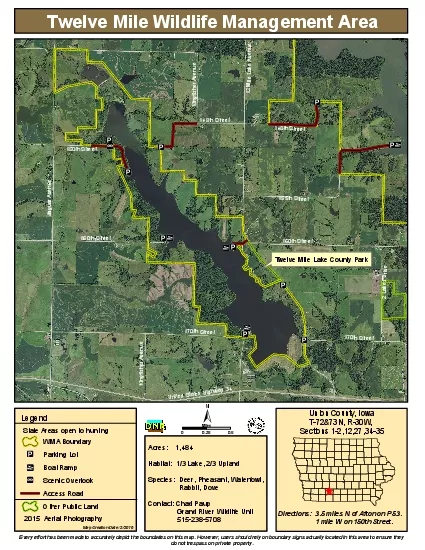
Twelve Mile Wildlife Management Area
by brianna
Acres 1484Habitat 1/3 Lake 2/3 UplandSpecies ...
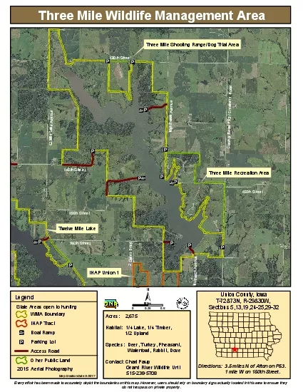
Three Mile Wildlife Management Area
by piper
Acres 2675Habitat 1/4 Lake 1/4 Timber ...
Annadel State ParkAnnadel State ParkHowarth Park
by tracy
Channel Drive Swimming Lagoon Jack RabbitMeadows U...
GEOLOGY OF THE GRANITE FALLS 7.5-MINUTE QUADRANGLE AREA—A RICH HISTORY OF NEOTECONIC BASIN DEVELO
by pamella-moone
Figure 2. . . Schematic north-south cross section...
Public Hearings July 12, 2016
by briana-ranney
Board of County Commissioners. Case: . CDR-15-10...
Cultus Lake Provincial Park Park Map and Information G
by sherrill-nordquist
Cultus Lake is one of the few meccas in the provi...
Public
by tawny-fly
Hearings. September 22, 2015. Board of County Com...
Lesson 1: Geography of the United States
by yoshiko-marsland
Geography. The study of our natural surroundings ...
[We need to]
by celsa-spraggs
“…explore the neighborhood, view the landscap...
BATTLEMENT CREEK FIRE USDI, Bureau of Land Management
by taylor
Grand Junction District. Glenwood Springs Resource...
MAPS II Cross-border
by tatyana-admore
Co-operation . and Policy Networks in West Africa...
Public
by natalia-silvester
Hearings. August 4, 2015. Board of County Commiss...
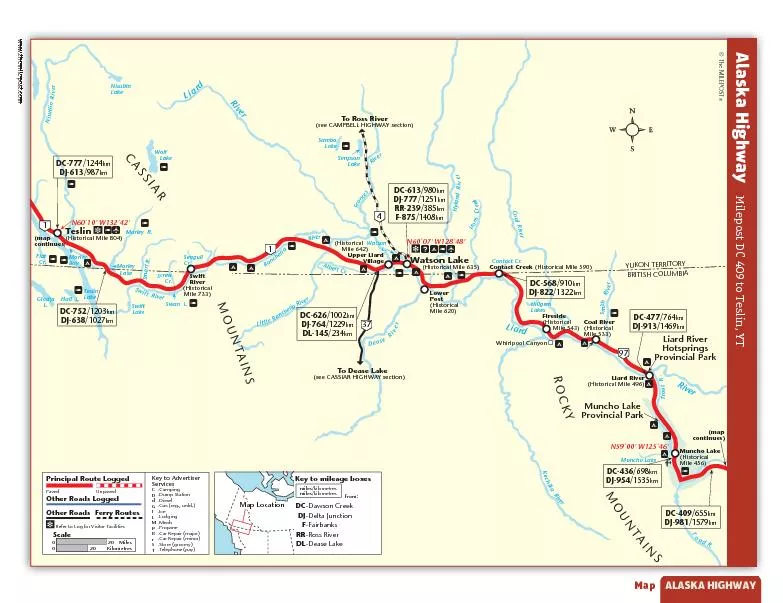
www.themilepost.com
by stefany-barnette
Map 97 4 1 1 37 To Dease Lake(see CASSIAR HIGHAY s...
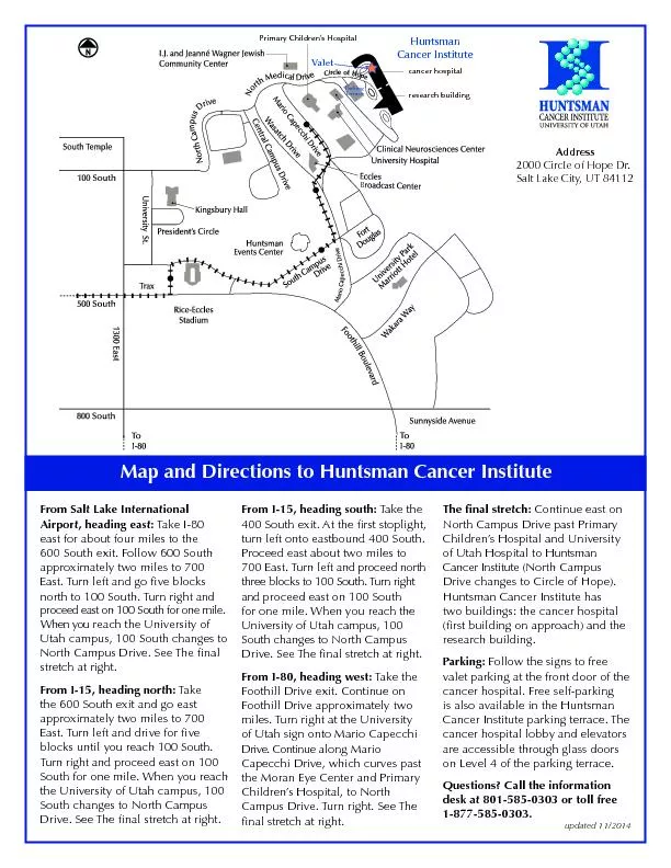
Map and Directions to Huntsman Cancer InstituteFrom Salt Lake Internat
by phoebe-click
B Vale Parking Terrac Huntsman Cancer Institutecan...
Public
by briana-ranney
Hearings. September 1, 2015. Board of County Comm...
Killarney featured in the OS map has a long history of huma
by kittie-lecroy
By . Aisling. . Boyhan. 6A1. Killarney Before T...
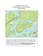
Kabetogama State Forest Hinsdale Island on Lake Vermilion Campsite Map
by trish-goza
There are 11 boat-in campsites (1-11) available fo...
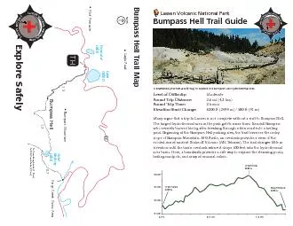
Bumpass Hell Trail Map
by olivia-moreira
1.7 0.7 BoilingEmeraldLakeLakeHelen To Crumbaugh L...
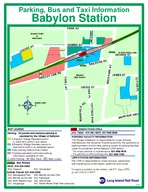
Argyle Lake Babylon High School to Post Office Ancient Order of Hibernians Parking Bus and Taxi Information Babylon Station MAP LEGEND Taxis Parking All permit and metered parking is operated by t
by lois-ondreau
LIRR STATION INFORMATION For snow removal or main...
FREE BUS SCHEDULE ROUTE MAP Whitefish Mountain Resort Base Lodge The Lodge at Whitefish Lake Stumptown Ice Den Good Medicine Lodge OShaughnessy Center Central Avenue Librar y North arking Lot rank
by test
Pine Lodge The WA VE Rocky Mountain Lodge Mountai...
Spatial Thinking Thinking About
by celsa-spraggs
© 2009 Phil . Gersmehl. Michigan Geographic All...
Defining an Earthquake
by tatiana-dople
and . Exploring Earthquakes far from . Plate Boun...
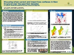
Mapping urban sprawl and impervious surfaces in New England over the past
by phoebe-click
Mapping urban sprawl and impervious surfaces in N...
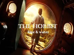
the hobbit Fire & water
by pinperc
The characters. BILBO BAGGINS. GANDALF . GOLAM. GA...
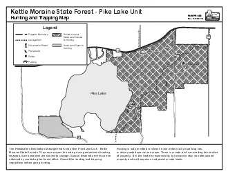
Kettle Moraine State Forest Pike Lake UnitHunting and Trapping Map
by elyana
Rev 10/22/2014The Headwaters Recreation Management...
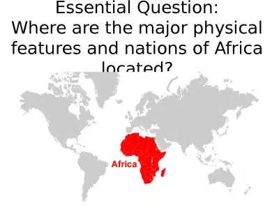
Essential Question: Where are the major physical features and nations of Africa located?
by deena
Standards:. SS7G1 Locate selected features of Afri...
Load More...


![[We need to]](https://thumbs.docslides.com/616028/we-need-to-.jpg)